
GSOC 2015 project proposal
Julio Bondia, Universitat Rovira i Virgili (URV) student, Spain
IS FAED Display
Preliminary
The main idea of FAED project is to use a drone to bring flying an automated electronic defibrillator (AED) where a cardiac emergency is happening. This drone will have a support platform with an easy extraction system in order to get the AED as fast as possible.
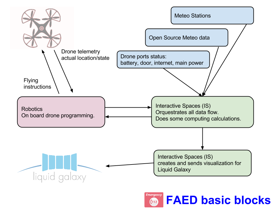
Liquid Galaxy technology use abstract: FAED Display will be a software engine that connects to data sources, converting and handle them accordingly, and displays them in the Liquid Galaxy. Data will be of many kinds, shapes, numbers, positions, etc. The data collection will be implemented using the Interactive Spaces platform.
Observation: I do not need the other colleague from Interactive Spaces data to make my project, more on this later. If I’m alone in this I’ll program emulators for all the needed data.
Project Description
As a part of the global project FAED, my project will consist on getting all the data from the FAED Mesh and display it on the Liquid Galaxy. This part will be an Interactive Spaces activity in charge of receiving data, format and check the right format before sending it to the Liquid Galaxy.
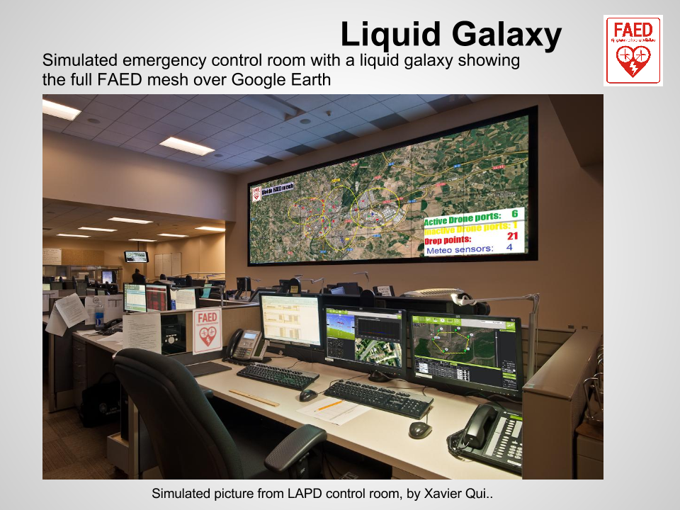
So the main idea here is to build and display the different layers in the mentioned system, which could be: drone movement, drone hangars (POIs) and its area of influence, drone points of landing, meteorology information, meteorology stations (POIs) etc.
What’s more, every drone will carry a Physical Web beacon which will be advertising an URL with the drone identifier. Once someone gets this URL, can see all the information related to this drone: where it comes from, where it is going, what emergency is giving support to, etc. This is a requirement from the law, to have any flying drone fully identified.
Linked Technologies
In order to deploy the present project will be needed to use different kind of technologies and know how they work, it happens because the data parsing is the process in the middle to communicate both platforms. A possible list of technologies needed will be:
- Deep knowledge in Liquid Galaxy, Interactive Spaces, and Google Earth platform generally.
- Deep knowledge of Interactive Spaces platform. According to this, good grasp of Java to get and format the received data to be represented in the Liquid Galaxy. Also good skills in C++, ROS, Linux.
- HTML5, Django/Grails (open source!) for the Physical Web websites, linked to an external.


